Winnats Pass
A magnificent winding road through a steep valley, with deep natural caverns at the bottom
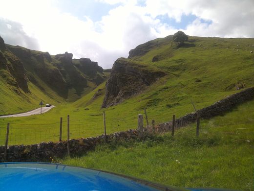
The narrow and winding Winnats Pass is located in the Peak District National Park in northern England near the village of Castleton. The road winds through a steep-sided valley surrounded by towering limestone ridges and pinnacles, including one which is, perhaps a little exaggeratedly, named Matterhorn Rib.
The pass was once thought to have originated as a large collapsed cave. However, a more recent explanation is that it was a ravine between the coral reefs, while the valley was formed by erosion after changes in elevation due to tectonic activity. Due to the narrowness of the road and its steep (1 in 3.5) gradient, it is closed to heavy vehicles. It has, however, regularly been used in cycle races since at least the 1950s.
There are numerous footpaths around Winnats Pass and a short walk up the pass and down by another route is well worthwhile. But do not be tempted to climb the sides of the pass unless you are an experienced climber, as it can be dangerous. In May 2016 a couple in their twenties scrambled up the pass side and got stuck near the top. They were saved after sending the mountain rescue team a selfie they had taken earlier.
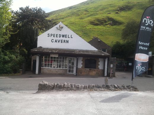
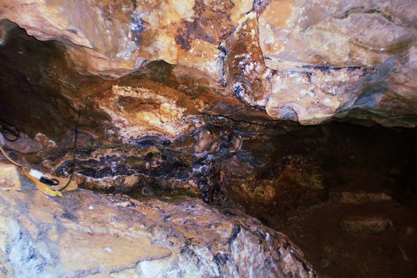
At the bottom of the pass is one of the four tourist caves in the Castleton area, and probably the most unusual, Speedwell Cavern. The natural cavern is reached down more than 100 steps, and the tour is conducted by boat in the flooded lead miners’ tunnel. Visitors board the electrically powered boats after descending the long steep stone staircase. The electric power is relatively recent; originally the guide propelled the boat by pushing against the walls by hand or even feet. The cave at the end of the underground canal includes some attractive veins of fluorspar and some nice stalactites and stalagmites but to many, the novelty of the underground boat ride is the main attraction.
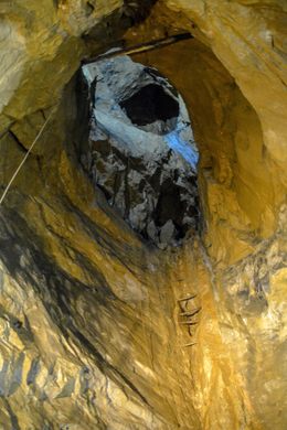
Also famous is the so-called “Bottomless Pit.” This pit was an extremely deep (about 490 feet) vertical shaft, full of water. Originally the miners could not plumb the bottom and because tipping mine waste into it did not raise the water level they assumed it was bottomless. This hydraulic behavior turned out to be due to an overflow passage below the water level. After years of waste disposal, the Bottomless Pit is now choked to within about 60 feet of the surface.
In 1999 the Speedwell system became even more notable in that a connection was discovered between the Speedwell Cavern system and a deep vertical shaft to the surface, Titan. The largest natural shaft in the UK is 464 feet deep and was itself discovered after many years of digging by cavers on the hillside above Speedwell.
On the northern flank at the bottom of Winnats is a small cave that can be easily explored with a flashlight (do not be put off by the name, Suicide Cave) and throughout the pass are numerous old mine tunnels and small caves.
Know Before You Go
The area has numerous fossils in the limestone, but it's a protected area and collection is not permitted. While several of the long limestone ribs are listed in local rock climbing guides, the owners of the pass, the National Trust, do not allow climbing. Nearby Mam Tor is not climbable—due to the fragile nature of the shale—except during some winters when the water seeping from the face freezes and makes for an easy ice climb. Night ascents are quite common.
There is a large gravel car park at Speedwell Cavern. It's pay parking, but is not expensive. There are public restrooms at the car park, and many hiking trails lead directly up and into the pass from there.
Nearby is Peak Cavern, and there is a price discount available for entry into both sites.









Follow us on Twitter to get the latest on the world's hidden wonders.
Like us on Facebook to get the latest on the world's hidden wonders.
Follow us on Twitter Like us on Facebook